
Cyclone Montha: East Coast on High Alert as Severe Storm Nears Andhra Pradesh and Odisha
Overview
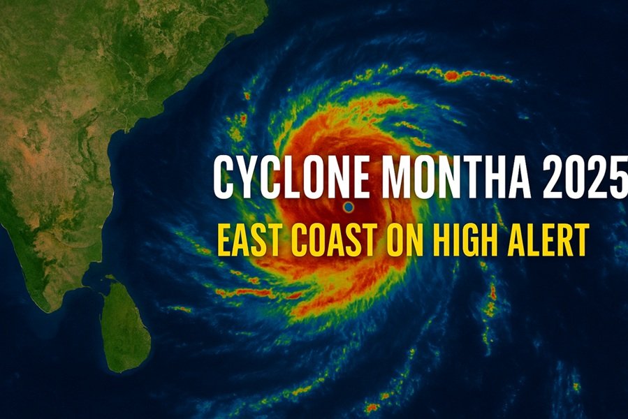
India’s eastern coastline is bracing for the impact of Cyclone Montha, a powerful tropical storm brewing over the Bay of Bengal. According to the India Meteorological Department (IMD), Montha has intensified into a severe cyclonic storm and is expected to make landfall between Machilipatnam and Kalingapatnam, near Kakinada in Andhra Pradesh, during the evening or night of Tuesday, October 28, 2025.
The storm, which is currently moving west-northwestward at a speed of 15–18 km/h, is bringing with it the threat of heavy rains, strong winds, and high tidal surges across Andhra Pradesh, Odisha, and parts of Tamil Nadu.
Meteorological Details
The IMD reports that Cyclone Montha is centered over the southwest and adjoining southeast Bay of Bengal, steadily gaining intensity as it approaches the coast. Sustained wind speeds are predicted to reach 90–100 km/h, with gusts possibly touching 110 km/h at the time of landfall.
The storm’s trajectory indicates a gradual northward shift, which may lead to widespread rainfall not only along coastal Andhra Pradesh but also across Odisha, Telangana, and coastal Karnataka in the next two days.
Officials have also warned of storm surges up to 1.5 meters above the normal tide, which could inundate low-lying areas along the coast.
Regions Under Alert
1. Andhra Pradesh:
Districts including Kakinada, Konaseema, East and West Godavari, Krishna, Bapatla, Prakasam, and Nellore have been placed under red and orange alerts. The state government has evacuated over 50,000 residents from vulnerable coastal villages to cyclone shelters. Schools and colleges across several districts will remain closed on October 28 and 29.
2. Odisha:
Southern and coastal districts such as Ganjam, Gajapati, and Puri are under orange alert. Emergency response teams and NDRF units have been deployed, with officials advising fishermen not to venture into the sea until further notice.
3. Tamil Nadu:
Although the storm’s main impact will be further north, northern coastal districts including Chennai, Tiruvallur, and Kanchipuram have seen moderate rainfall and gusty winds. Cloudy skies and intermittent showers are expected to continue through midweek.
4. Karnataka and Kerala:
The IMD has warned of isolated heavy rainfall in coastal Karnataka and northern Kerala due to the cyclone’s peripheral effects.
Transport Disruptions
- The East Coast Railway has cancelled over 40 trains operating between Andhra Pradesh and Odisha as a precautionary measure.
- Several flights from Visakhapatnam Airport and Vijayawada Airport scheduled for October 28 have been cancelled or rescheduled due to deteriorating weather conditions.
- Authorities have urged people to avoid unnecessary travel and to stay indoors once wind speeds begin to rise.
Government Preparedness and Response
State governments and disaster management teams have swung into action:
- Andhra Pradesh Disaster Response Force (APDRF) has set up control rooms and emergency helplines in all coastal districts.
- The Indian Navy and Coast Guard are on standby for rescue and relief operations.
- Power and communication infrastructure teams have been deployed to restore services quickly in case of outages.
- Essential supplies, including dry rations, medicines, and drinking water, are being pre-positioned in cyclone-prone regions.
In Virpur and Konaseema, residents have been advised to move inland, while fishermen have been told to secure their boats and nets well in advance.
Expected Weather Impact
- Andhra Pradesh: Extremely heavy rainfall (over 200 mm in 24 hours) likely in East and West Godavari, Konaseema, and Krishna districts.
- Odisha: Heavy rainfall ranging from 70 mm to 150 mm expected in southern and coastal districts.
- Tamil Nadu: Moderate showers with occasional heavy spells in northern coastal regions.
- Telangana and Karnataka: Scattered heavy rain possible as the system weakens after landfall.
The IMD has warned of potential flooding, uprooting of trees, and damage to kutcha houses, electric poles, and crops.
Precautions for Residents
- Stay indoors during heavy rain and wind.
- Avoid traveling near coastlines and low-lying areas.
- Keep essential items like flashlights, drinking water, and medical kits ready.
- Follow official advisories from IMD and local disaster management authorities.
- Avoid spreading rumors or unverified information on social media.
Humanitarian Perspective
Cyclone Montha, the first major tropical storm of the post-monsoon season, serves as a stark reminder of the Bay of Bengal’s vulnerability to extreme weather events. The region’s low-lying coastal geography makes it particularly susceptible to flooding and displacement.
However, improved forecasting systems, timely alerts, and the rapid response of disaster management authorities have significantly enhanced preparedness compared to previous years. Early evacuation efforts and coordination between the central and state governments are being praised for minimizing potential loss of life.
Expert Insights
Meteorologists suggest that rising sea surface temperatures in the Bay of Bengal have contributed to the storm’s rapid intensification. Experts from the Indian Institute of Tropical Meteorology (IITM) note that climate change has increased the frequency of “rapid intensification” of tropical cyclones, demanding greater preparedness in coastal zones.
Dr. Rajesh Nair, a senior climatologist, explains:
“Cyclone Montha reflects a new climate reality — storms are forming faster and intensifying more rapidly. Early warning systems and community-level awareness are the strongest tools we have against such disasters.”
Conclusion
As Cyclone Montha moves closer to India’s eastern shores, authorities remain on high alert to minimize damage and safeguard lives. The next 24 to 48 hours will be critical, especially for coastal Andhra Pradesh and southern Odisha, where the storm is expected to strike hardest.
With prompt evacuations, coordinated relief efforts, and vigilant public awareness, India hopes to weather this storm with resilience and unity.
“Stay alert, stay safe, and trust the official updates. Nature’s fury is powerful — but human preparedness can save lives.”